


Voting District 18, Doddridge County, West Virginia
About
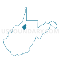
Outline

Summary
| Unique Area Identifier | 690561 |
| Name | Voting District 18 |
| County | Doddridge County |
| State | West Virginia |
| Area (square miles) | 27.80 |
| Land Area (square miles) | 27.80 |
| Water Area (square miles) | 0.00 |
| % of Land Area | 100.00 |
| % of Water Area | 0.00 |
| Latitude of the Internal Point | 39.18342900 |
| Longtitude of the Internal Point | -80.81119200 |
Maps


Graphs
Select a template below for downloading or customizing gragh for Voting District 18, Doddridge County, West Virginia


Neighbors
Neighoring Voting District (by Name) Neighboring Voting District on the Map
- Voting District 11, Ritchie County, WV
- Voting District 13, Ritchie County, WV
- Voting District 17, Doddridge County, WV
- Voting District 2, Doddridge County, WV
- Voting District 20, Doddridge County, WV
- Voting District 27, Gilmer County, WV
- Voting District 4, Doddridge County, WV
Top 10 Neighboring County Subdivision (by Population) Neighboring County Subdivision on the Map
- Union district, Ritchie County, WV (3,315)
- Pine district, Doddridge County, WV (2,487)
- Oak district, Doddridge County, WV (1,870)
- De Kalb-Troy district, Gilmer County, WV (1,704)
Top 10 Neighboring Unified School District (by Population) Neighboring Unified School District on the Map
- Ritchie County School District, WV (10,449)
- Gilmer County School District, WV (8,693)
- Doddridge County School District, WV (8,202)
Top 10 Neighboring State Legislative District Lower Chamber (by Population) Neighboring State Legislative District Lower Chamber on the Map
- State House District 6, WV (18,363)
- State House District 7, WV (18,054)
- State House District 33, WV (16,880)
Top 10 Neighboring State Legislative District Upper Chamber (by Population) Neighboring State Legislative District Upper Chamber on the Map
Top 10 Neighboring 111th Congressional District (by Population) Neighboring 111th Congressional District on the Map
Top 10 Neighboring Census Tract (by Population) Neighboring Census Tract on the Map
- Census Tract 9677, Gilmer County, WV (6,390)
- Census Tract 9623, Ritchie County, WV (4,168)
- Census Tract 9650, Doddridge County, WV (4,104)
- Census Tract 9651, Doddridge County, WV (4,098)
- Census Tract 9625, Ritchie County, WV (3,023)